Lingering storm threat with heavy rain as heat ramps up in southern Ontario
Slow moving thunderstorms shift into eastern Ontario Wednesday, with lingering risk for torrential rain and hail
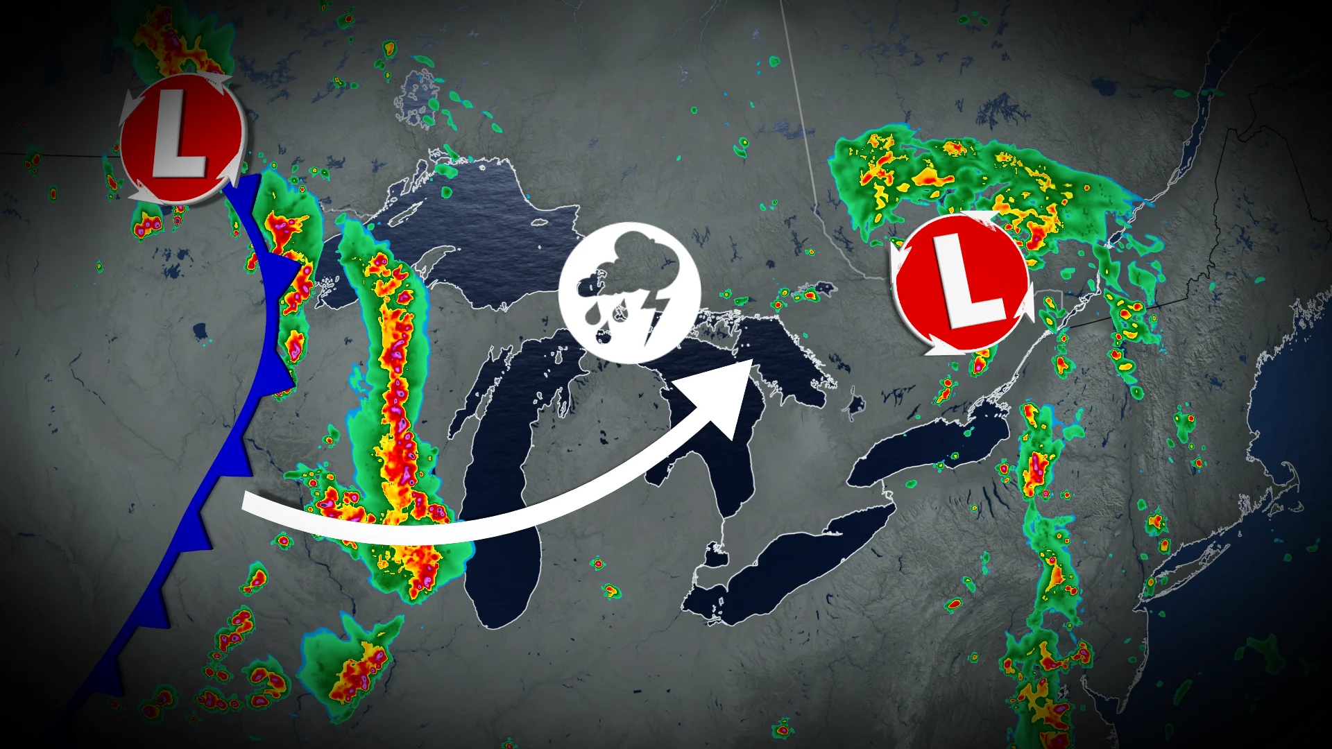
Heat and humidity are building across Ontario this week, accompanied by an increasing risk of thunderstorms.
Temperatures will feel like the 30s, with humidex values nearing the 40s. The warmest days are forecast for Wednesday and Thursday.
DON'T MISS: Visit our complete guide to Summer 2026 for an in-depth look at the Summer Forecast, tips to plan for it and much more!
The muggy air will help to fuel a thunderstorm risk, as well with the threat for torrential downpours and large hail at times.
Heavy rain and hail risk in eastern Ontario Wednesday
Isolated, slow-moving thunderstorms are expected to develop in eastern Ontario on Wednesday afternoon, affecting areas from Petawawa and Ottawa to Cornwall. These storms carry the potential for torrential rain and a slight chance of hail around 2 cm.
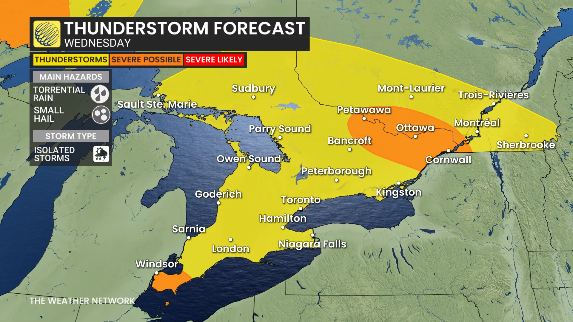
For the Greater Toronto Area (GTA), conditions will remain mostly clear following morning convection, though a slight chance exists for a trailing storm in the afternoon.
PHOTOS: Reported tornadoes in Manitoba and Saskatchewan as severe storms hit
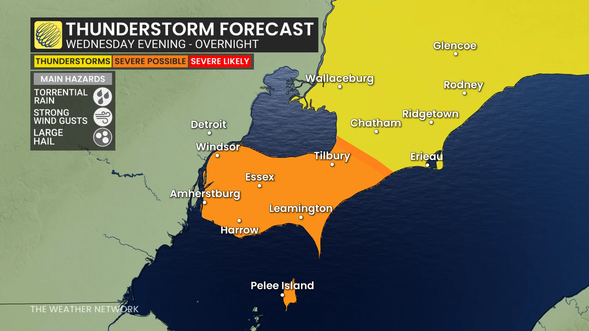
Meanwhile, Windsor-Essex could see a passing thunderstorm Wednesday evening, with risks of heavy rain and the possibility of large hail.
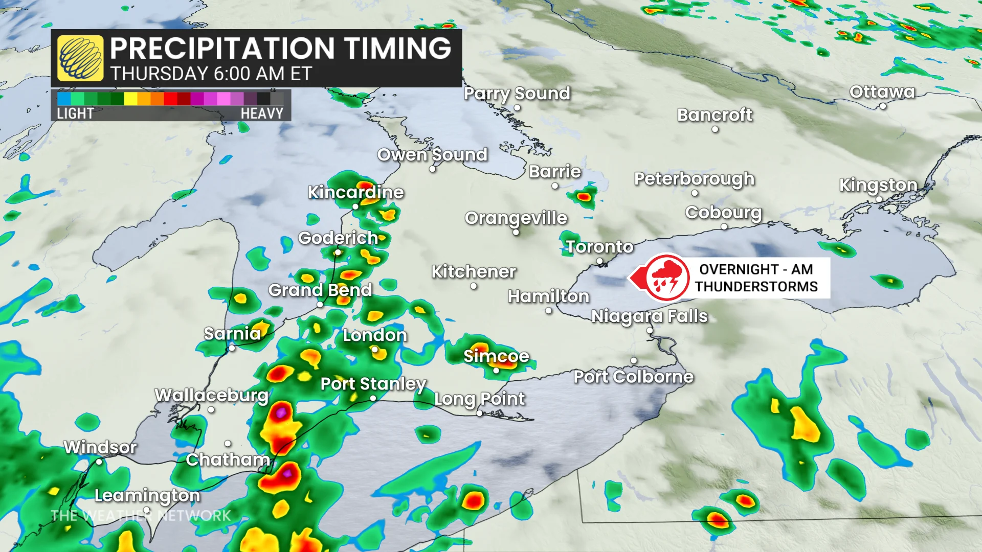
Overnight Wednesday into Thursday morning, thunderstorms are forecast to track into the region from Michigan, bringing rounds of thunder, lightning, and heavy rain across southern Ontario, including the GTA.
This could lead to a rainy commute early Thursday.
By Thursday afternoon, isolated thunderstorms may develop along a trailing trough and instability, potentially affecting the GTA and areas farther east. Thunderstorm activity is also being monitored for Thursday overnight, with storms potentially moving in from the U.S. Upper Great Lakes region. However, there is still considerable uncertainty regarding the severity and timing of these storms over southern Ontario.
DON'T MISS: Watch? Warning? How we communicate severe weather in Canada
Southern Ontario to be well-watered over the next two weeks, noticeable drop in temperatures
Showers and thunderstorms remain a possibility this weekend in southern Ontario, although most of the weekend is expected to stay dry. Sunday will see a noticeable drop in temperatures, and highs near the 401 corridor could reach the upper teens to lower 20s, with cottage country staying cooler in the mid-to-upper teens.
Looking ahead, the region is expected to experience cooler-than-seasonal temperatures throughout next week, along with periods of unsettled weather. These conditions suggest the potential for consistent moisture in southern Ontario over the next two weeks.