Severe storms with large hail, tornado risk threaten Manitoba, NW Ontario
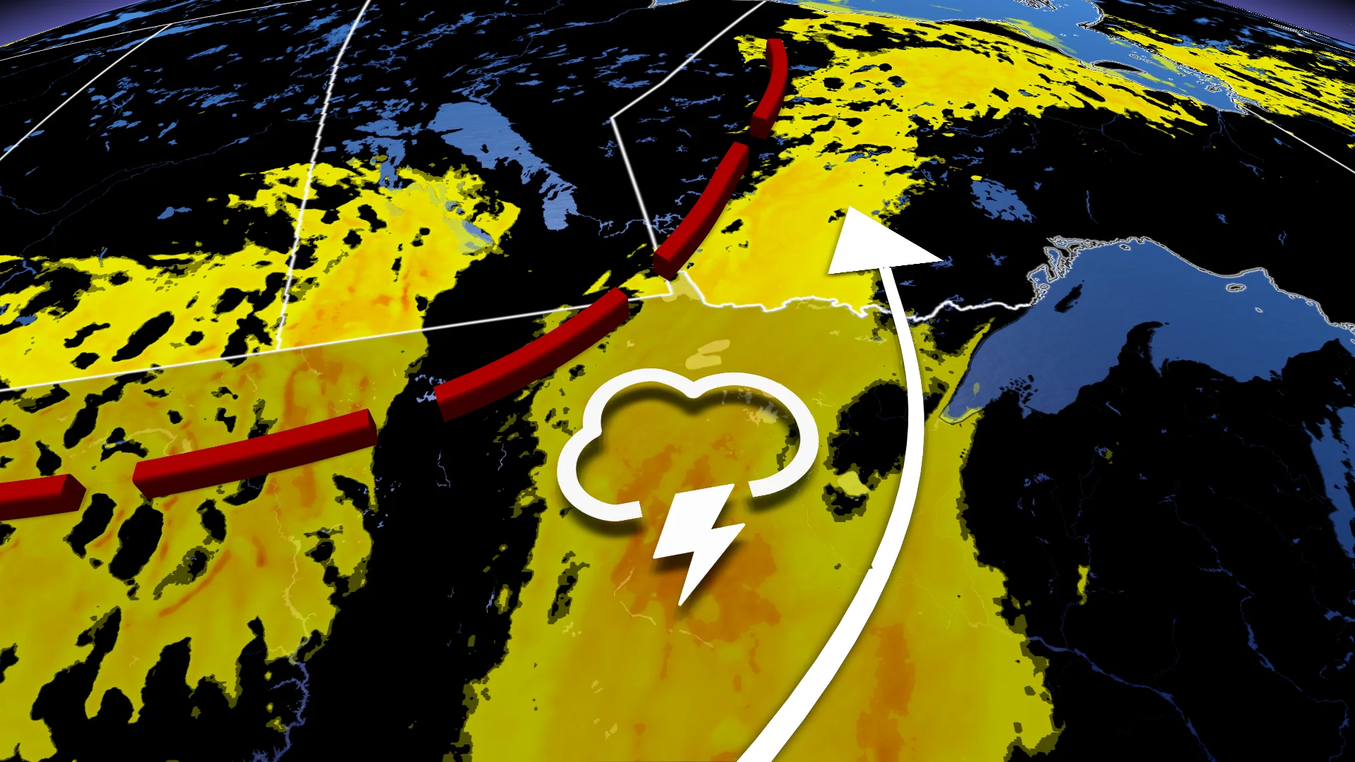
A moist and unstable air mass will bring the risk of severe thunderstorms with heavy rain, large hail, damaging winds, and isolated tornadoes across the Manitoba–Ontario border Wednesday
Severe weather that brought at least two confirmed tornadoes and widespread power outages across the Prairies on Tuesday is shifting east. Southern Manitoba and northwestern Ontario are now in the path of potential storm activity.
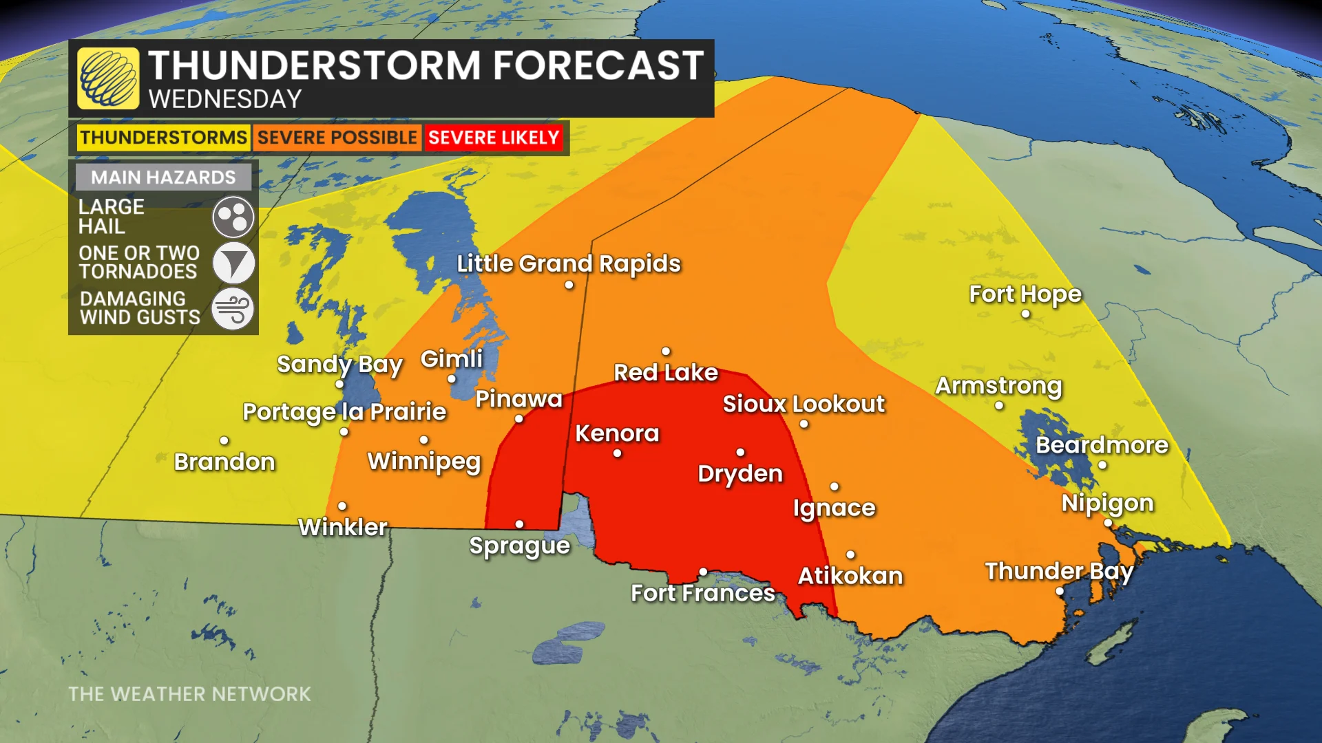
Wednesday’s storm risk includes the possibility of large hail, damaging winds, and isolated tornadoes in affected areas.
RELATED: Tornado 101: What you need to know about staying safe
Residents are advised to stay alert for severe weather warnings even after unwinding and turning in for the night.
Severe weather risk hits the Manitoba-Ontario border Wednesday
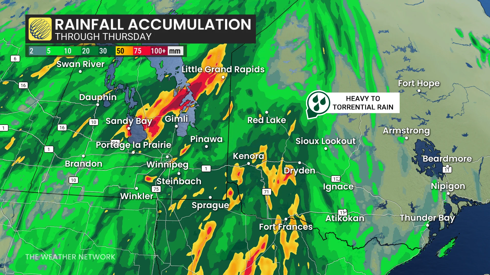
A very moist and unstable air mass continues to influence the region Wednesday, sustaining a risk for severe thunderstorms. Heavy rain and thunderstorms are ongoing Wednesday morning along the Manitoba–Ontario border, gradually shifting into far northern Ontario by the afternoon.
Severe thunderstorms are expected to develop Wednesday afternoon near the southern Manitoba–Ontario border and along the international boundary.
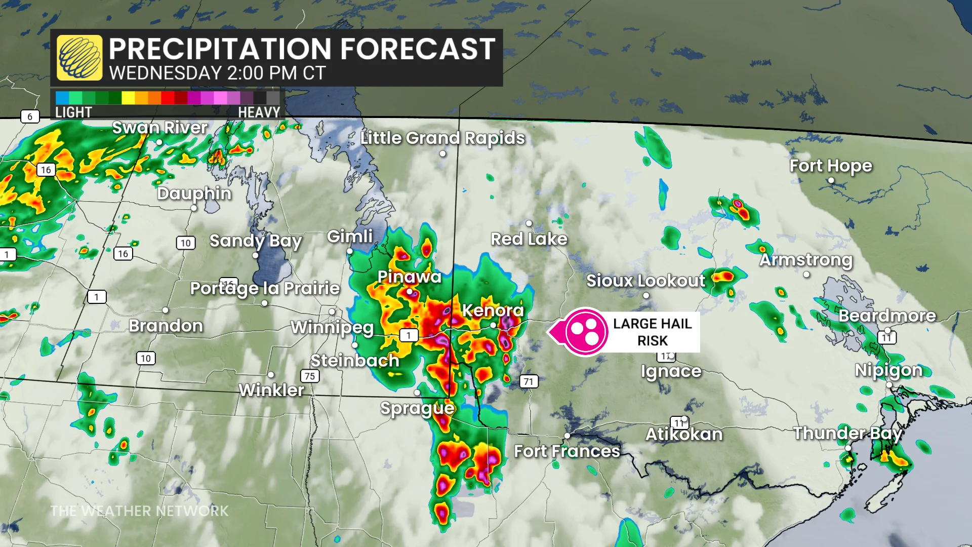
These storms will be disorganized and clustered, with threats of heavy rain, large hail (2 cm or more), and damaging winds, particularly near sunset. Isolated tornadoes or brief spin-ups are also possible due to embedded rotation.
100+km/h: Brace for outages with powerful winds
By early evening, these storms are forecast to organize into a strong squall line. Damaging wind gusts of 90–100+ km/h are expected to sweep through northwestern Ontario overnight, with the potential for embedded tornadoes.
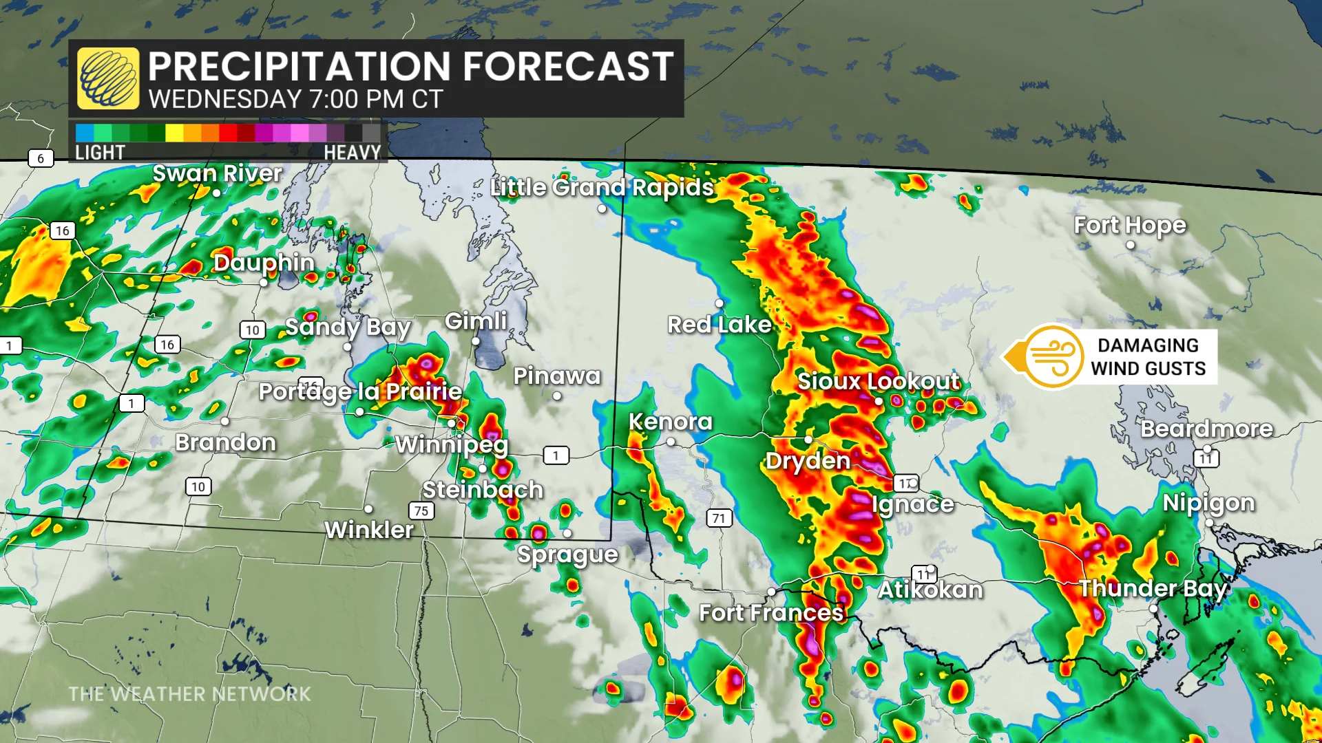
Power outages and travel disruptions are possible, particularly along Highways 1, 11, and 17.
Relief from this period of severe weather is expected Thursday as the risk shifts towards the Upper Great Lakes region in the U.S.
While severe weather will diminish across the Prairies, non-severe, isolated storms remain possible in the coming days. Stay weather-aware and monitor updates for any warnings.
WATCH: Spectacular supercell steals the show on the Prairies
Severe weather safety is paramount
Pay close attention to rapidly changing weather conditions in your area. For tips on what to do in case a tornado warning is issued, click here.

Scout out a safe place to take shelter in your home well before storms approach your location. The safest place is an interior room on the lowest level of the building. The goal is to put as many walls as possible between you and flying debris.
If you’re in a vehicle and a tornado warning is issued, pull over at the nearest sturdy shelter. Never try to outrun a tornado.
Residents in impacted areas are urged to keep cell phones charged ahead of the storm in case of any power disruptions or outages to receive weather alerts (click here to see how to turn on alert notifications from The Weather Network app).
Stay with The Weather Network for all the latest on conditions across the Prairies.