Winnipeg and surrounding area drenched in wild night of stormy weather
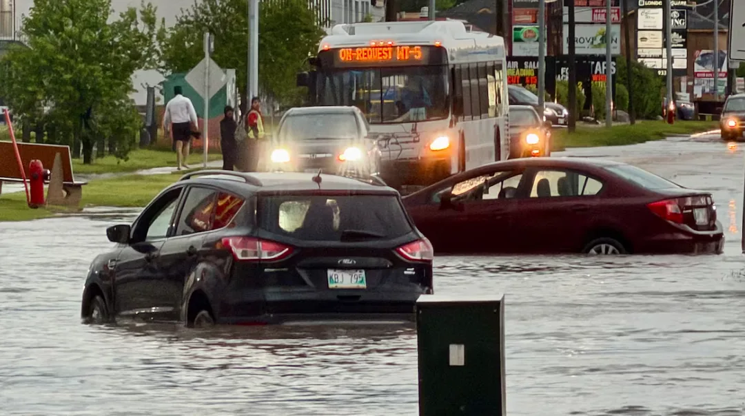
Southern Manitoba saw a wild night of storms with monsoon-like downpours, unconfirmed reports of tornadoes and vehicles abandoned on flooded roads.
Nowhere was hit with more rain than Stonewall, just north of Winnipeg, where more than 250 millimetres had been reported by 3 a.m. Wednesday, according to Environment Canada.
A few kilometres northwest of there, Woodlands received more than 120 mm.
Winnipeg was drenched with 117 mm recorded at The Forks, leaving reports around the city of inundated basements, impassable streets and engulfed underpasses. And many other weather stations in the province reported over 50 mm, Environment Canada said.
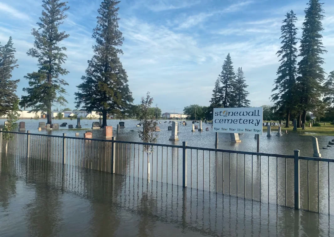
The Stonewall Cemetery on Wednesday morning. (Cory Funk/CBC)
The intense weather was spread across the south with wind gusts clocked at 130 kilometres an hour in the Deloraine area, in the southwestern corner near the Saskatchewan border.
Wind gusts in excess of 100 km/h were reported in several other places, with Brandon hitting 100 km/h and Winnipeg clocking a peak of 94 km/h.
There was also hail, ranging from the size of nickels to tennis balls in parts of Winnipeg, Sanford and Otterburne.
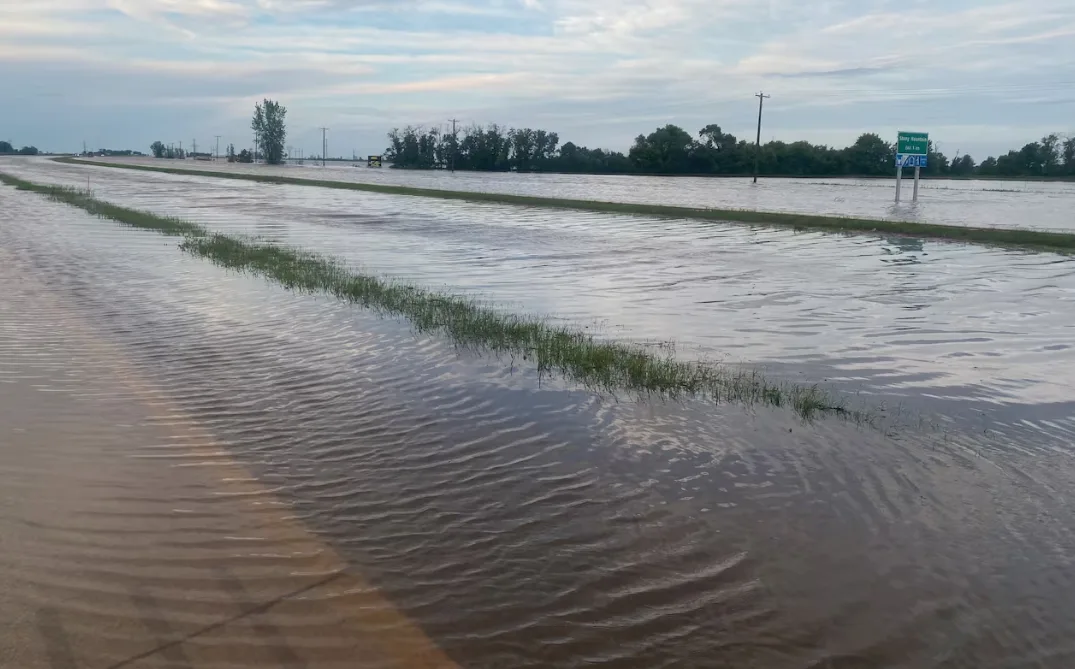
Highway 7 is seen just north of Stony Mountain Wednesday morning. (Cory Funk/CBC)
There were unconfirmed reports of tornadoes around Ste. Anne, southeast of Winnipeg, and Otterburne, just south of the city, and other possible tornadoes through much of the Red River Valley and the Parklands area on the west side of the province, Environment Canada says.
There were also numerous reports of funnel clouds, the weather agency said.
“There was lots of rotation with the storm and it got down pretty low,” said Environment Canada meteorologist Kyle McAuley, who noted the weather system started south of Emerson in the U.S. and moved north through Manitoba.
Although no possible tornado sightings were reported in Winnipeg, the city was under threat, McAuley said.
“We were definitely at risk a few times … [due to] thunderstorms that were rotating pretty violently," he said.
"This is by far the closest day, within a few years that I could recall, of a tornado hitting Winnipeg or being near Winnipeg."
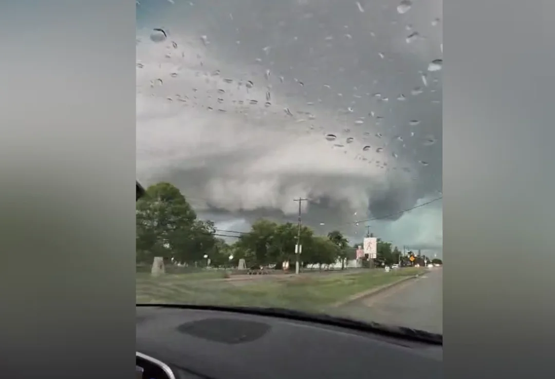
A possible supercell over Ste. Anne around 5:30 p.m. on Tuesday. (Submitted by Ksenia McKie)
Ste. Anne also saw what was likely a supercell, an ominous tower of rotating cloud that had the potential to turn into a major twister.
"It was definitely close," McAuley said. "Luckily there doesn't seem to be too much damage reports yet, which is which is a good thing. And no life has been taken. Hopefully that's [the news that is] going to continue throughout the day."
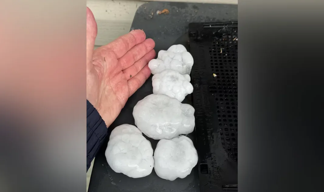
Hailstones are seen near Sanford, Man., Tuesday afternoon. (Submitted by Cameron Crump)
Manitoba Hydro says hundreds of power outages are affecting thousands of customers in the province.
FORECAST: Severe storms with large hail, tornado risk threaten Manitoba, NW Ontario
The Crown corporation is bringing in addition staff to relieve firefighters and police in Winnipeg who are guarding scenes where live wires have fallen, it said in a news release.
VIDEO: Parts of Manitoba see over 200 mm of rain
Thumbnail courtesy of Travis Golby/CBC.
The story was originally and published for CBC News. With files from Julie Buckingham.